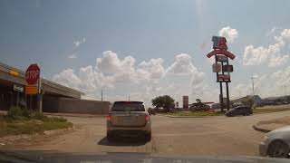
Driving around Amarillo, Texas
Driving around Amarillo, Texas

The city of Amarillo, originally named Oneida, is situated in the Llano Estacado region. The availability of the railroad and freight service provided by the Fort Worth and Denver City Railroad contributed to the city’s growth as a cattle-marketing center in the late 19th century.
Amarillo was once the self-proclaimed “Helium Capital of the World” for having one of the country’s most productive helium fields. The city is also known as “The Yellow Rose of Texas” (as the city takes its name from the Spanish word for yellow), and most recently “Rotor City, USA” for its V-22 Osprey hybrid aircraft assembly plant. Amarillo operates one of the largest meat-packing areas in the United States. Pantex, the only nuclear weapons assembly and disassembly facility in the country, is also a major employer. The location of this facility also gave rise to the nickname “Bomb City”. The attractions Cadillac Ranch and Big Texan Steak Ranch are located adjacent to Interstate 40. U.S. Highway 66 also passed through the city.
Amarillo is located near the middle of the Texas Panhandle. It does not share similar weather characteristics with south and east Texas. It is situated in the grasslands of the Texas Panhandle, and is surrounded by dense prairie. Amarillo is infamous for its unpredictable weather patterns, with massive temperature changes on a daily basis, raging winds, devastating hailstorms and “northers”, long periods of drought, late frosts, spring tornadoes, dust-storms, and floods.
Though urbanization, agricultural farming, and construction have occurred over the last century in and around Amarillo, the native grasslands that dominate this region have remained largely untouched. Amarillo sits closer in proximity to the Oklahoma, New Mexico and Colorado state capitals than it does to Austin. The region’s surface is relatively flat and has little soil drainage. Due to the lack of developed drainage, much of the rainfall either evaporates, infiltrates into the ground, or accumulates in playa lakes. According to the United States Census Bureau, the city has a total area of 90.3 square miles (234 km2), with 89.9 sq mi (233 km2) of it land and 0.4 sq mi (1.0 km2) of it (0.50%) covered by water. The Amarillo metropolitan area covers four counties: Armstrong, Carson, Potter, and Randall.
